A view of the Tioughnioga River from the Port Watson Street Bridge in 1899 In the collection of Cortland County Historical Society


(This story was written prior to our Streets of Cortland series and was part of our “Forgotten Places of Cortland County” series from 2019.)
Have you ever wondered where the name “Port Watson” came from? We have both a street and a bridge that are called Port Watson, but there is certainly no port to be found. Would you believe that there actually was a bustling port on the Tioughnioga River and the surrounding community was called Port Watson? It is an interesting story that begins around 1800 before Cortland County was even established as a county in its own right. We were a part of Onondaga County at that time.
Elkanah Watson was an enterprising man who, with partners, Thomas Tillotson and David Dickson, purchased three 600-acre Military Tract* lots from Andrew Stockholm. The plan was to develop a town and that is exactly what they did. The area of the Port Watson village ran about ¼ mile in a north-south direction and about 1/6 mile in an east-west direction. The area that includes Kennedy Parkway to Port Watson Street gives you a better idea of where the village was. The area was divided into lots of similar size, except for areas where the terrain was irregular. Streets were laid out and named. As of 1806, 30 lots had been sold, 66 were assigned to surveyor Henry I. Stewart and 89 were reserved for future sale. According to Spafford’s New York State Gazeteer of 1810, 25 houses and stores were in Port Watson while only 10-12 houses were in the village of Cortland. Homer was really growing and had 70 houses and stores.
Positioned at the confluence of the east and west branches of the Tioughnioga River, Port Watson was full of promise. Its population was outpacing that of Cortland Village, and river navigation was the best way to transport goods over long distances. Arks of up to 90 feet long were loaded with all manner of goods, including potash, whiskey, gypsum, and grain. The arks were navigated to far-away places like Baltimore and Washington, D. C., where the goods were sold and the arks were dismantled and sold for lumber. Many of the arks had fun names like Gold Hunter, Lazy Tom, and Sour Crout. We have a tale from the Crazy Jane which set sail on April 6, 1818. Manned by Luman Rice and headed for Harrisburg, Crazy Jane was laden with gypsum. A few days into the journey, Rice had a serious accident. Rice had coiled a length of rope around his left arm that was also secured to the vessel. He put the other end of the rope around a tree that leaned over the river, and you can well imagine that with the momentum of the large moving boat, Rice’s arm was instantly severed. He fell into the river and swam a distance before he was retrieved, and his wounded arm amputated.
1806 map of Port Watson Village In the collection of Cortland County Historical Society

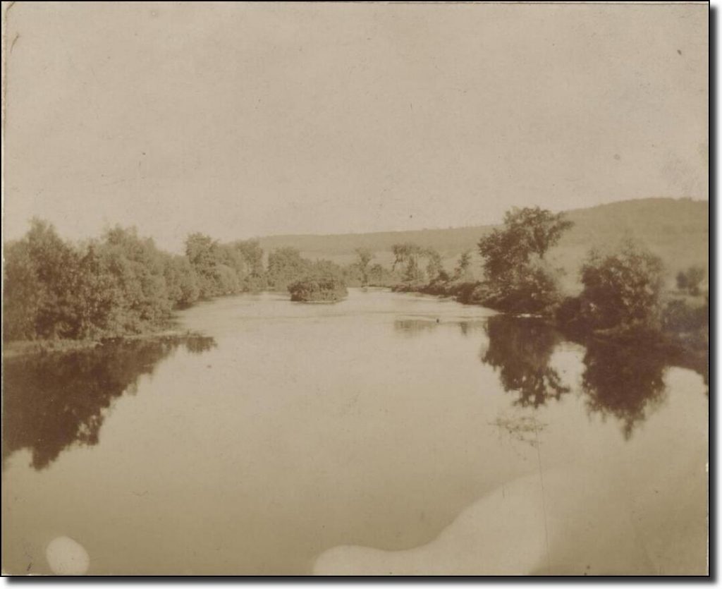
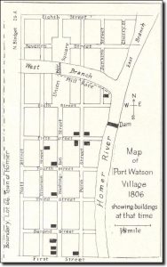
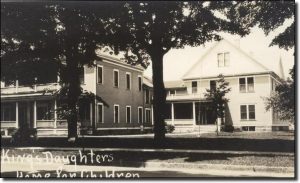
Elkanah Watson carefully planned the layout of Port Watson as well as its purpose. First and foremost, it would be a source of cheap and speedy shipping to points south. Docks and warehouses were important to the success of Port Watson. Goods were brought in the winter via sleds and stored in warehouses until spring and better navigation weather. Secondly, the river would provide a ready source of power for the all-important mills that Watson envisioned. The first mill established in the village was a sawmill built by Luther Rice in 1808, and a paper mill which was built by Nelson Spencer in 1820. A tannery was started in 1824 by William Elder. A store was a must and a grand hotel was erected which housed the post office.** This building eventually came to be used as the King’s Daughter’s Children’s Home and it sat where the present-day BOCES and Seven Valleys Tech school is located today.

The King’s Daughters Children’s Home In the collection of Cortland County Historical Society
The village flourished briefly, but the demise of Port Watson was slow and sure. As more dams were built further up the river, the flow was more and more restricted, and as such, river transportation was not as reliable as it had been. In spite of the great success of river transportation for trade, there were many drawbacks, including the seasonal nature of it. There was a glut of products placed on the market in the spring which likely depressed the value of goods. The opening of the Erie Canal in 1825 certainly contributed to the collapse of Port Watson. Goods could be made available more consistently between the Erie Canal, better roads, and finally, the arrival of the railroad. Eventually, the village was absorbed into Cortland Village which became the City of Cortland in 1900.
The next time you drive over the Port Watson Bridge, imagine for a moment what it must have looked like over 200 years ago: the busy boatyard and wharves, the bustling activity of loading the arks, and the crowds of people who would gather on the riverbanks to watch the boats launch on their maiden (and only!) voyage. Was your ancestor on an ark as a crew member? Or was he or she a small child on the riverbank watching the big event? It’s fun to imagine the scene! ~Tabitha
NOTES:
*A large part of Central New York was part of the Military Tract, land that was given to Revolutionary War soldiers for their service.
**The list of Cortland County post offices lists April 8, 1808, as the date of establishment for the Port Watson post office, but the post office was likely there prior to that date. Before that date, one would have to consult Onondaga County records.

Comments are closed, but trackbacks and pingbacks are open.